MapBiomas Perú
  • About Mapbiomas
    • Project
    • Products
    • About Us
    • Team
    • Other Initiatives
    • Premio MapBiomas Peru
    • Terms of Use
  • Maps and Data
    • Access the Platform
    • Statistics
    • Downloads
    • Accuracy
    • Terms of Use
  • Methodology
    • Methodology Overview
    • ATBD – Step by Step
    • Method MapBiomas Water
    • Vegetation Modules Methodology
    • Tools
    • Glossary
    • Terms of Use
  • FAQ
  • Communication
    • Releases
    • MapBiomas Articles
    • News
    • Technical notes
    • Videos
    • Brand guidelines
    • Terms of Use
  • Contact
User
MapBiomas

MapBiomas Articles

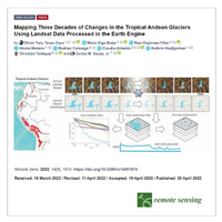
Turpo et al. Mapping Three Decades of Changes in the Tropical Andean Glaciers Using Landsat Data Processed in the Earth Engine

This paper presents the mapping and retreat dynamics of tropical Andean glaciers (TAGs) using Landsat time-series images from 1985 to 2020, with digital processing and classification of the satellite images on the Google Earth Engine platform.

Provided by Seeg

Powered by Google earth engine

© 2025 MapBiomas. All rights reserved.

Language

Development EcoStage