GOOGLE EARTH ENGINE
MapBiomas uses technology from the Google Earth Engine platform. We provide scripts to facilitate access to the MapBiomas collections.
To access and run follow the following instructions:
- With a Gmail account sign up for the Google Earth Engine Platform through this link https://earthengine.google.com
- A confirmation email will immediately arrive to access the platform.
- Upon receiving the confirmation notification, enter the link of the scripts you want to run.
- Adjust the parameters according to the requirement to obtain the desired map.
We encourage SCRIPT MAPBIOMAS users to send us their suggestions for innovation so that we can constantly improve it.
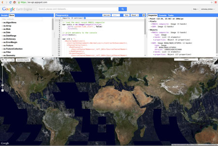
Access to MapBiomas collection on Google Earth Engine
Las colecciones de imágenes y mapas de MapBiomas están disponibles como assets directamente en Google Earth Engine, sin la necesidad de descargar o subir datos. Acceda al tutorial video sobre el uso del toolkit. A continuación se presentan los productos disponibles y los respectivos IDs de acceso en Google Earth Engine:
Mapas de cobertura y uso de la Colección 3 MapBiomas Perú
id: projects/mapbiomas-public/assets/peru/collection3/mapbiomas_peru_collection3_integration_v1
Mapas de transición entre años seleccionados de la Colección 3 MapBiomas Perú
id: projects/mapbiomas-public/assets/peru/collection3/mapbiomas_peru_collection3_transitions_v1
Mosaico de Imágenes Landsat para cada año de la Colección 3 MapBiomas Perú
id 1 (1985-2021): projects/nexgenmap/MapBiomas2/LANDSAT/PANAMAZON/mosaics-2
id 2 (2022-2024): projects/mapbiomas-raisg/MOSAICOS/mosaics-2
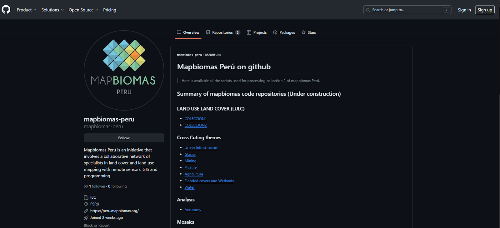
GITHUB
MapBiomas Peru Processing Code Repository
The codes used by MapBiomas Peru to produce the maps, including classification, spatial and temporal filters, data integration, generation of transitions and calculation of statistics, among others, are available in the code repository on GitHub.
Access https://github.com/mapbiomas-peru